Search Results
Installation work to begin December 13 for Next Generation Fare Gates at Hayward Station
Installation of Next Generation Fare Gates is scheduled to begin December 13 at Hayward Station. The installation process is expected to take approximately two weeks to complete.
During construction, there will be a barrier around the existing station gate array. Riders will use two temporary accessible gates to enter and exit Hayward Station. Both gates are located next to the Station Agent Booth. When facing the booth from the non-paid area of the station, the fare gate to your right is used to enter the station and the fare gate to your left is used to exit. Additionally, a carpet will be installed immediately before the entrance to each temporary gate to make the gates easier to locate for riders with visual impairments.
The work will not impact train service, but riders may experience a few extra minutes wait to pass through the fare gates during peak travel hours.
The latest work comes after BART has successfully installed Next Generation Fare Gates at 11 other stations across the system. All 50 BART stations will have new fare gates by the end of 2025. You can learn more about BART’s Next Generation Fare Gate at the project page. Riders can provide feedback about the new gates at bart.gov/comments.
Installation work to begin the week of September 3rd for Next Generation Fare Gates at Richmond Station
Installation of Next Generation Fare Gates is scheduled to begin the week of September 3rd at Richmond Station. The installation process is expected to take approximately two weeks to complete. This work comes after the successful installation of Next Generation Fare Gates at Civic Center, Fruitvale, and West Oakland stations.
During construction, there will be a barrier around the existing station gate array. Riders will use two temporary accessible gates to enter and exit Richmond Station. Both gates are located next to the Station Agent Booth. When facing the booth from the non-paid area of the station, the fare gate to your right is used to enter the station and the fare gate to your left is used to exit. Additionally, carpet will be installed immediately before the entrance to each fare gate, to make these two gates easier to locate for riders with visual impairments. The removal of the old gates and installation of Next Generation Fare Gates will not impact train service.
All BART stations will have new fare gates by the end of 2025. You can learn more about BART’s Next Generation Fare Gate project at bart.gov/about/projects/fare-gate. Riders can provide feedback about the new gates at bart.gov/comments.
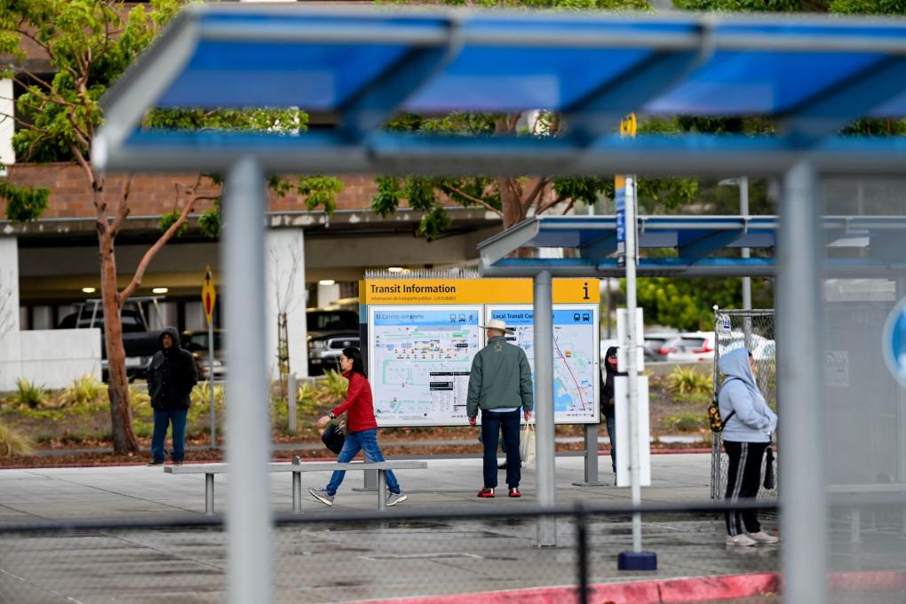
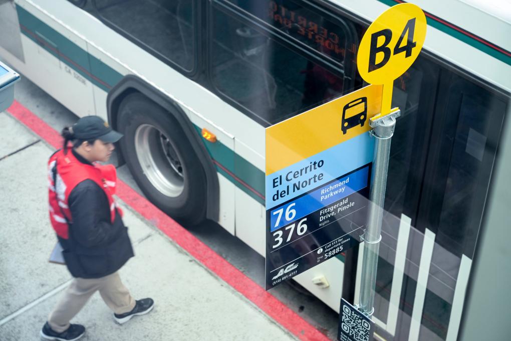
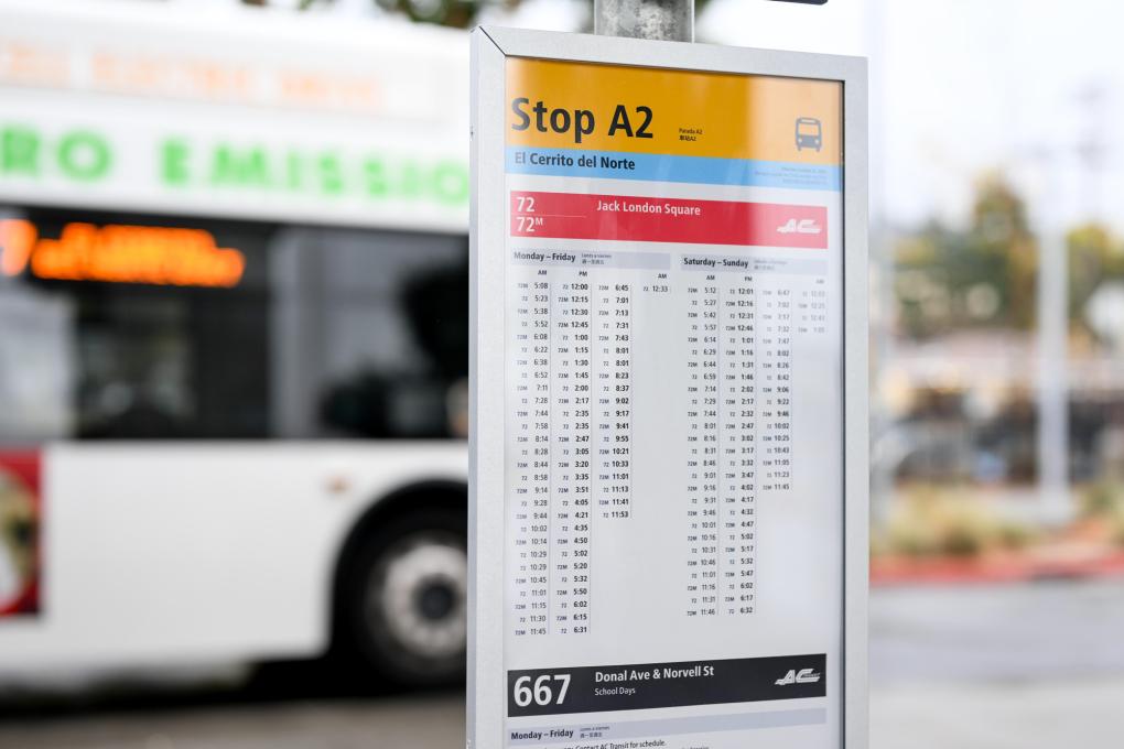
New test transit maps and signs debut at El Cerrito del Norte Station
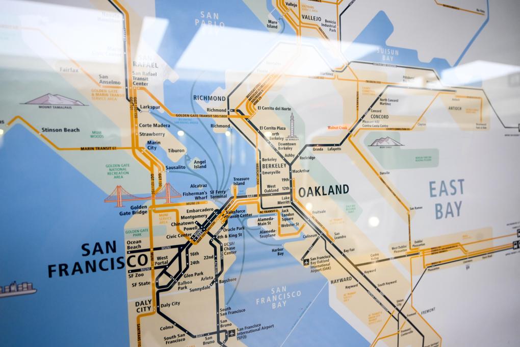
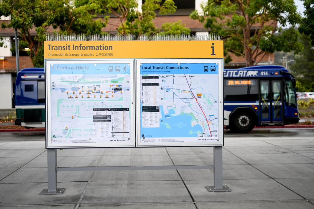
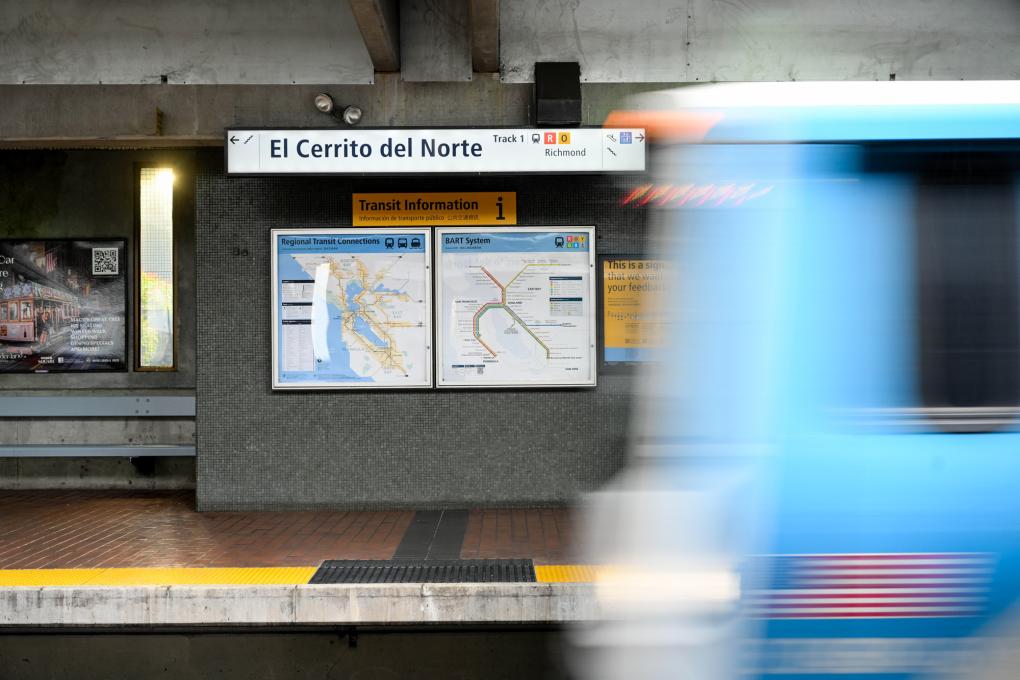
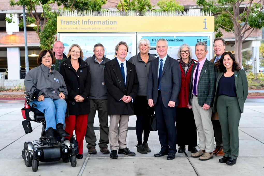
Today, Dec. 12, at El Cerrito del Norte Station, BART, Bay Area transit agencies, and the Metropolitan Transportation Commission (MTC) unveiled new test transit maps and signs designed to help make transit journeys easier to understand for both existing and new riders by delivering information that is clear, predictable, and familiar across service areas and county lines. A new comprehensive transit map, which will enable riders to discover key destinations they can reach on the Bay Area's extensive rail, bus, and ferry network, also was released.
Today’s event kicked off the start of an evaluation period for the Regional Mapping & Wayfinding project, in which BART, MTC, and transit partners invite Bay Area residents and visitors to share their thoughts about the test signs and maps now installed at El Cerrito del Norte Station. Several “test” prototype signs and other communication materials also will be installed at the Santa Rosa Transit Mall/Downtown Santa Rosa SMART station later this month. Members of the public, including those who are unable to visit one of the test locations in El Cerrito or Santa Rosa, are invited to take this online survey to share their feedback and ideas.
“Transit in the Bay Area and elsewhere is still suffering the effects of the pandemic,” said Sue Noack, vice chair of MTC’s Regional Network Management Committee and Pleasant Hill City Councilmember. “But these maps and signs are tangible examples of the work MTC and the transit agencies are doing together to make the Bay Area’s system simpler, easier to use, and more affordable.”
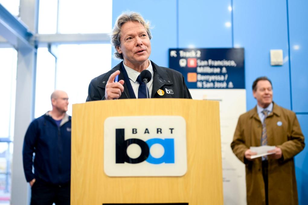
Said BART General Manager Bob Powers: "This is not just a BART project, but a collaborative effort across regional transit agencies to experiment and innovate together. This project will move away from the disjointed look of the region's current transit signage and maps and make it easier for riders to know how to get from point A to point B, especially those who are new to riding Bay Area transit. I am thrilled that all of our agencies and the MTC have worked together to make this important project happen."
Transit riders will be able to engage with the test materials during their journeys and share their ideas about how to make new signs and maps work better for them. This public feedback will help inform the next stage of the project in which the new maps and wayfinding materials are expected to be installed at seven additional locations across the Bay Area in 2025 and 2026.
The new maps and signs are part of the larger Regional Mapping and Wayfinding initiative aimed at making it easier to ride transit in the Bay Area. Whether a rider is traveling by bus, rail, ferry, or a combination, the signs, maps, screens and other communication systems will be consistent and easy to identify across all nine Bay Area counties.
The Regional Mapping and Wayfinding Project — led by MTC in partnership with BART and over two dozen Bay Area transit agencies as well as transit riders and Bay Area cities and counties — is the result of a first-of-its-kind effort to redesign and harmonize maps and signage across all nine Bay Area counties to help people navigate transit more easily. This project is just one piece of a broader effort outlined in the Bay Area Transit Transformation Action Plan, which is focused on making Bay Area transit easier and more convenient for riders of all ages and abilities to use.
The Regional Network Management Council includes top executives from BART, MTC, the San Francisco Municipal Transportation Agency, AC Transit, the Santa Clara Valley Transportation Authority (VTA), Caltrain, SamTrans and the Golden Gate Bridge, Highway and Transportation District, as well as three general managers representing all other transit agencies serving Bay Area communities, including BART General Manager Bob Powers.
MTC is the regional transportation planning, financing and coordinating agency for the nine-county San Francisco Bay Area.
Bus Bridge Alert: Hazardous tree removal and track work between Glen Park and Daly City on first weekend in December (12/2-3)
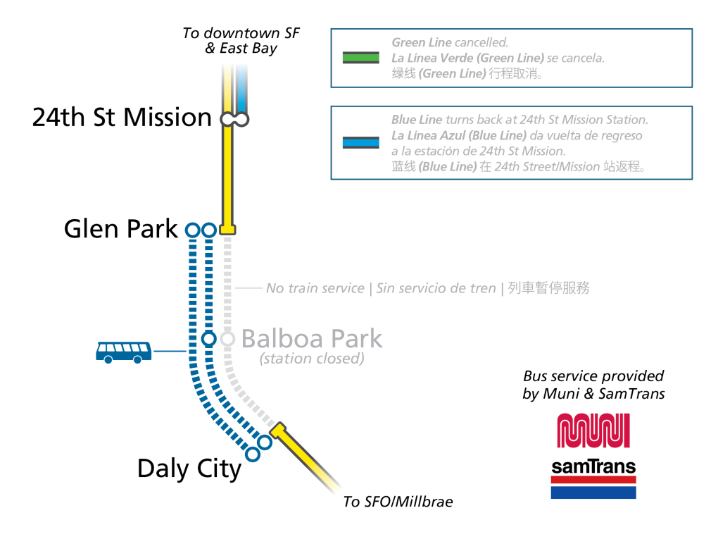
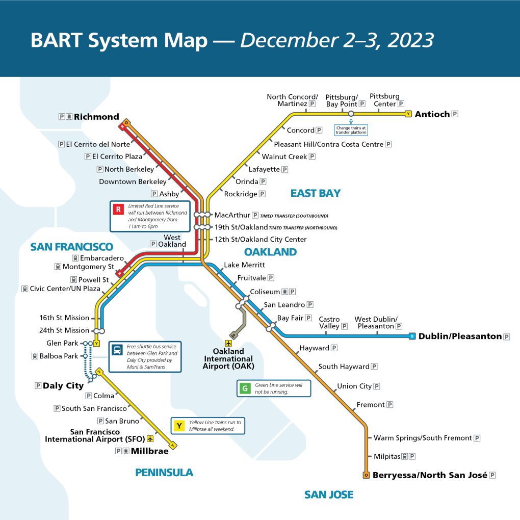
BART’s safety initiative to remove potentially hazardous trees in advance of severe winter storms will next focus on San Francisco and Daly City. To provide crews with enough room to safely do the work, free buses will replace trains between Glen Park and Daly City stations the first weekend in December, Saturday December 2, and Sunday December 3. Riders in the area should anticipate delays of up to 30 minutes. If the weather should interfere with the work on December 2-3, then the tree removal will be rescheduled for the following weekend, December 9-10.
Riders in the area on the work weekend will have to get off their train at Glen Park or Daly City and then board a free bus to get to the next station in their direction of travel to continue their trip. Some buses will run directly between Glen Park and Daly City while others will stop at Glen Park, Balboa Park, and Daly City.
Service from the East Bay to Downtown San Francisco
The Yellow and Blue lines will serve the downtown San Francisco stations. The Blue line will turn back at the 24th Street/Mission and the Yellow line will turn back at Glen Park. Blue Line riders traveling beyond 24th Street/Mission will need to walk across the platform and take the Yellow line train to the bus bridge at Glen Park.
Green line service will be cancelled on both days of the track shutdown.
To provide some increased transbay frequency, BART will run some Red line Richmond to Montgomery and Montgomery to Richmond trains between 11:00am and 6pm.
Service between Daly City and SFO/Millbrae and Millbrae/SFO to Daly City
BART will run only one line between Daly City and SFO/Millbrae and Millbrae/SFO to Daly City with service every 20 minutes. Each train will make all stops including SFO and Millbrae. These trains departure times will not match our normal timetable, but will run every 20 minutes. Riders traveling beyond Daly City will need to board the bus bridge.
Late Night Cancelled Train
The last northbound train of the night normally scheduled to leave Millbrae at 11:52pm and SFO at 12:00am will be cancelled both evenings of the track shutdown. Riders instead should plan to catch the 11:40pm departure from Millbrae that leaves SFO at 11:48pm.
BART will make the most of the weekend when this segment of the system will be closed by also working on trackway improvements. You can learn more about BART’s safety initiative to remove potentially dangerous trees on the project page.
You can keep up with the latest updates for trackway repair projects that impact service by going to our Alerts and Advisories page. BART’s Trip Planner has been improved to show the full customer journey including bus bridges. You can also check Real Time Departures for your station of choice.
Tap and Go payment
Lake Merritt Station: entrance closure on April 7
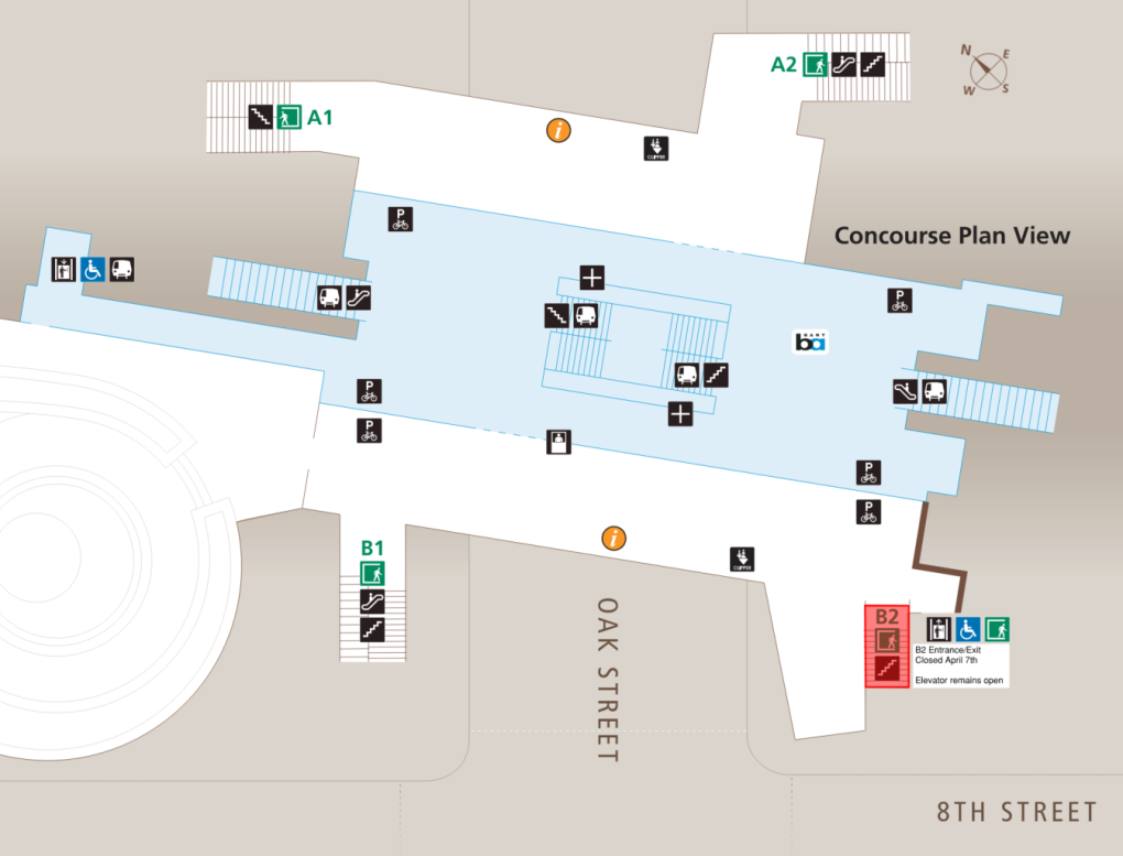
On Monday, April 7, 2025, the south entrance to the Lake Merritt BART Station will be closed for the day to support the construction of affordable housing on the former BART parking lot.
The entrance being closed for the day is at the corner of Oak St. and 8th St. (see map). The elevator at this location will remain open. All other entrances to Lake Merritt Station will remain open.
For more information about the Transit-Oriented Development (TOD) project, visit:
Single Tracking Alert: Late night rail work on the Yellow Line in Contra Costa County (next work dates 4/10-11)
BART must perform rail maintenance work between Orinda and Lafayette stations. To create safe clearance for our crews, BART will reduce service from two tracks to one while the work is taking place. The work each night is scheduled to start at 10pm and continue until BART service begins the next morning. Riders can anticipate delays of 15-20 minutes on work nights.
Dates scheduled for this work include:
*April 10-11
*April 24-25
*May 8-9
*May 22-23
Outreach begins on SF escalator and entrance improvements
Thanks to State Proposition 1B and the City of San Francisco, BART has received $12 million that gives us the opportunity to make extensive improvements to escalators and entrances at some of our downtown San Francisco stations. We have entered into a planning and design process to determine the best use of
Link21 Program awarded $11.3 million in new state funding to advance planning of second transbay train crossing
The Link21 program, which is envisioned in the California State Rail Plan, has been awarded $11.3 million by a state program that funds transformative transit and rail capital improvements to significantly reduce emissions of greenhouse gases, vehicle miles traveled, and congestion. The California State
Bus Bridge Alert: Hazardous tree removal and track work between Pleasant Hill and Concord on 2 non-consecutive weekends
BART’s safety initiative to remove potentially hazardous trees in advance of severe winter storms will next focus on Contra Costa County. To provide workers with enough room to safely do the work, free buses will replace trains between Pleasant Hill and Concord stations on 2 non-consecutive weekends in October. The work dates are October 14-15 and October 28-29. Riders in the area should anticipate delays of up to 30 minutes on work weekends. Riders in the area on work weekends will have to get off their train at either Pleasant Hill or Concord and then board a free bus provided by County Connection to the next station in their direction of travel to continue their trip.
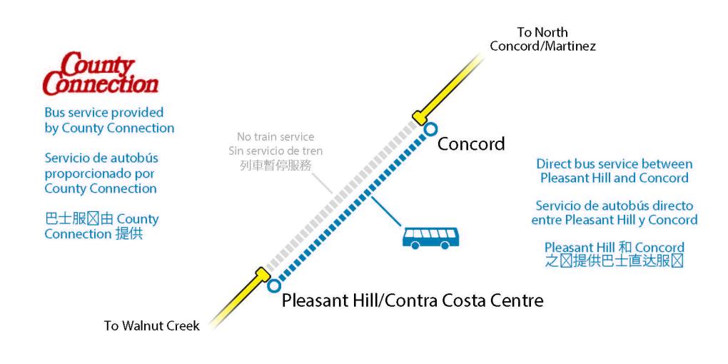
San Francisco-bound riders who want to avoid the bus bridge should start their trips at Pleasant Hill. On each night of the weekend shutdowns the last scheduled departure from Antioch to Concord that normally leaves at 11:48 pm will be cancelled. Riders traveling westbound from Antioch must catch the earlier train at 11:28 pm each night.
BART will make the most of the time when this segment of the system will be closed by also working on trackway improvements. You can learn more about BART’s safety initiative to remove potentially dangerous trees on the project page.
You can keep up with the latest updates for trackway repair projects that impact service by going to our Alerts and Advisories page. BART’s Trip Planner has been improved to show the full customer journey including bus bridges. You can also check Real Time Departures for your station of choice.
